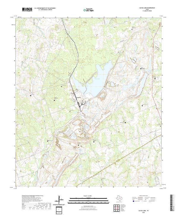
2022 Map of Alcoa Lake
USGS Topo · Published 2022About this map
The community of Sandow and the expansive Alcoa Lake characterize this central Texas landscape along the border of Milam and Lee counties. Numerous family-named burial grounds, such as Hamilton Chapel Cem and the Richards - Black Cem, suggest a history of deep-rooted rural settlement patterns. The terrain is defined by the convergence of several waterways, including Rocky Creek, Walleye Creek, and East Yegua Creek, which feed into the primary reservoir area. Extensive road networks like FM 1786 and Co RD 446 connect these small family enclaves and cemeteries, such as Bryant - Massingill Cem and Millerton Cem. The survey provides a clear view of the transition between agrarian land and the industrial developments associated with the lake, offering researchers a look at how regional infrastructure has developed around these older rural landmarks.
Find a feature on this map
55 named features on this map. Tap any name to fly to it.
Don’t see what you’re looking for? This feature index may not catch every label — zoom into the map to look around manually.
Map Details
Editions of this 2022 Alcoa Lake Map
This is the sole edition of this map. No revisions or reprints were ever made.
Other maps of this area

1885 · Taylor
USGS Topo · 1:125,000

1885 · Bastrop
USGS Topo · 1:125,000

1887 · Taylor
USGS Topo · 1:125,000

1893 · Bastrop
USGS Topo · 1:125,000

1894 · Taylor
USGS Topo · 1:125,000

1904 · Bastrop
USGS Topo · 1:125,000

1919 · Dime Box
USGS Topo · 1:62,500

1948 · Lexington
USGS Topo · 1:62,500

1950 · Lexington
USGS Topo · 1:62,500

1954 · Austin
USGS Topo · 1:250,000