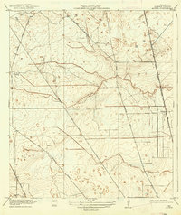
1919 Map of Aldine
USGS Topo · Published 1937About this map
Aldine and the surrounding rural landscapes of Harris County appear here as they were surveyed in 1916, during a period of agricultural transition and rail-dependent growth. The town sits along the International and Great Northern (Galveston Line), a critical rail link connecting Houston to the coast. The topography is defined by the gradual drainage of the gulf coastal plain, where Greens Bayou, Halls Bayou, and Turkey Cr meander through low-lying areas.
Find a feature on this map
14 named features on this map. Tap any name to fly to it.
Don’t see what you’re looking for? This feature index may not catch every label — zoom into the map to look around manually.
Map Details
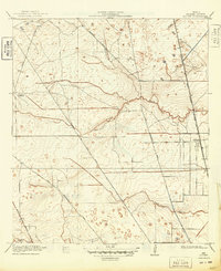
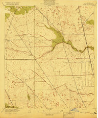
Editions of this 1919 Aldine Map
3 editions found
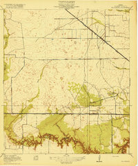
Other maps of this area

1915 · Houston Heights
USGS Topo · 1:24,000

1915 · Hillendahl
USGS Topo · 1:24,000

1916 · Aldine
USGS Topo · 1:24,000

1916 · Settegast
USGS Topo · 1:24,000

1916 · Louetta
USGS Topo · 1:24,000

1916 · Satsuma
USGS Topo · 1:24,000

1916 · Humble
USGS Topo · 1:24,000

1916 · Spring
USGS Topo · 1:24,000
1918 · Hillendahl
USGS Topo · 1:31,680
1919 · Aldine
USGS Topo · 1:31,680