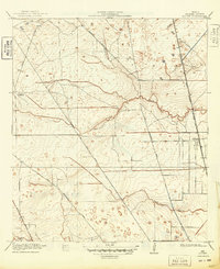
1919 Map of Aldine
USGS Topo · Published 1949About this map
The settlement of Aldine is captured here as a small rail-side community, years before the massive 20th-century expansion of Houston. The landscape is defined by the winding paths of Greens Bayou, Halls Bayou, and Whiteoak Bayou, which snake through a flat coastal plain marked by subtle 1-foot contour intervals. This detailed surveying reveals a rural network of early thoroughfares like Kuyendahl Road and Stuebner Air Line Road that would eventually become major arteries. A sparse but established social infrastructure is visible through the Hargrove School and a lone Cem, reflecting the scattered homesteads of the 1910s. The presence of the Great Northern (Galveston Line) and the Trinity and Brazos Valley rail routes highlights the importance of railroad transportation in connecting Harris County to the Gulf and the interior.
Find a feature on this map
14 named features on this map. Tap any name to fly to it.
Don’t see what you’re looking for? This feature index may not catch every label — zoom into the map to look around manually.
Map Details
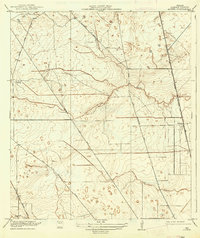
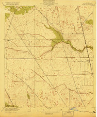
Editions of this 1919 Aldine Map
3 editions found
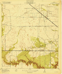
Other maps of this area

1915 · Houston Heights
USGS Topo · 1:24,000

1915 · Hillendahl
USGS Topo · 1:24,000

1916 · Aldine
USGS Topo · 1:24,000

1916 · Settegast
USGS Topo · 1:24,000

1916 · Louetta
USGS Topo · 1:24,000

1916 · Satsuma
USGS Topo · 1:24,000

1916 · Humble
USGS Topo · 1:24,000

1916 · Spring
USGS Topo · 1:24,000
1918 · Hillendahl
USGS Topo · 1:31,680
1919 · Aldine
USGS Topo · 1:31,680