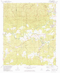
1979 Map of Aldrich
USGS Topo · Published 1980About this map
The industrial and spiritual foundations of central Alabama are clearly visible where the Little Cahaba River meets Shoal Creek. This 1970s landscape is anchored by the historic Bibb Furnace Ruins, a marker of the region's iron-making heritage. Settlement patterns follow the winding path of the Southern railroad, connecting towns like Aldrich, Wilton, and Brierfield.
Find a feature on this map
47 named features on this map. Tap any name to fly to it.
Don’t see what you’re looking for? This feature index may not catch every label — zoom into the map to look around manually.
Map Details
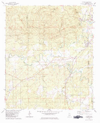
Editions of this 1979 Aldrich Map
2 editions found
Other maps of this area

1890 · Bessemer
USGS Topo · 1:125,000

1891 · Clanton
USGS Topo · 1:125,000

1892 · Bessemer
USGS Topo · 1:125,000

1899 · Brookwood
USGS Topo · 1:125,000

1910 · Montevallo
USGS Topo · 1:62,500

1934 · Blocton
USGS Topo · 1:48,000

1940 · Blocton
USGS Topo · 1:62,500

1953 · Montgomery
USGS Topo · 1:250,000

1953 · Birmingham
USGS Topo · 1:250,000

1956 · Birmingham
USGS Topo · 1:250,000