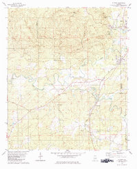
1979 Map of Aldrich
USGS Topo · Published 1984About this map
The Little Cahaba River and its tributary Furnace Branch carve through this industrial and agricultural landscape where the borders of Bibb, Shelby, and Chilton counties meet. In the late 1970s, the area remained a hub of extraction and local commerce, evidenced by the numerous Chert Pits, a Claypit, and a Gravel Pit scattered across the terrain. The presence of the Bibb Furnace Ruins serves as a tangible link to the region's iron-working heritage along the Southern railroad line. Small communities like Aldrich, Brierfield, and Ashby are anchored by local institutions such as Carlton Hill Ch and the Brierfield Cem. Crossing points like McGuire Ford and Fitch Bridge highlight how the local population navigated the winding river system, while the northern edge of the map features recreational developments like the Golf Course and College Lake.
Find a feature on this map
47 named features on this map. Tap any name to fly to it.
Don’t see what you’re looking for? This feature index may not catch every label — zoom into the map to look around manually.
Map Details
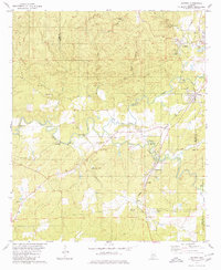
Editions of this 1979 Aldrich Map
2 editions found
Other maps of this area

1890 · Bessemer
USGS Topo · 1:125,000

1891 · Clanton
USGS Topo · 1:125,000

1892 · Bessemer
USGS Topo · 1:125,000

1899 · Brookwood
USGS Topo · 1:125,000

1910 · Montevallo
USGS Topo · 1:62,500

1934 · Blocton
USGS Topo · 1:48,000

1940 · Blocton
USGS Topo · 1:62,500

1953 · Montgomery
USGS Topo · 1:250,000

1953 · Birmingham
USGS Topo · 1:250,000

1956 · Birmingham
USGS Topo · 1:250,000