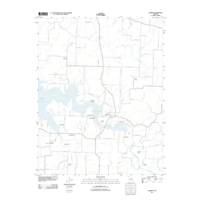
2011 Map of Aldrich
USGS Topo · Published 2011About this map
Aldrich serves as a focal point on this landscape, positioned where the intricate fingers of Stockton Lake reach into the surrounding Missouri countryside. The topography is defined by the convergence of several waterways, including Bear Creek, Barren Creek, and the Little Sac River, which have carved out distinctive local landmarks. Notable terrain features such as Blair Bluff, Knothead Hill, and Tommy Bluff rise above the valleys and lake arms, providing a varied vertical relief to the region.
Find a feature on this map
86 named features on this map. Tap any name to fly to it.
Don’t see what you’re looking for? This feature index may not catch every label — zoom into the map to look around manually.
Map Details
Editions of this 2011 Aldrich Map
This is the sole edition of this map. No revisions or reprints were ever made.
Other maps of this area

1884 · Springfield
USGS Topo · 1:125,000

1884 · Bolivar
USGS Topo · 1:125,000

1886 · Stockton
USGS Topo · 1:125,000

1886 · Greenfield
USGS Topo · 1:125,000

1886 · Springfield
USGS Topo · 1:125,000

1888 · Greenfield
USGS Topo · 1:125,000

1892 · Bolivar
USGS Topo · 1:125,000

1950 · Cliquot
USGS Topo · 1:24,000
1951 · Cliquot
USGS Topo · 1:24,000

1954 · Springfield
USGS Topo · 1:250,000