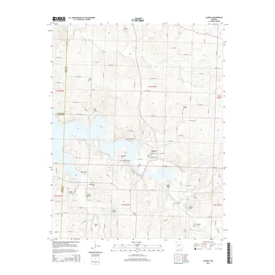
2015 Map of Aldrich
USGS Topo · Published 2015About this map
Stockton Lake dominates the central landscape of this western Missouri quadrangle, where the impounded waters of the Little Sac River and its many tributaries have altered the traditional valley topography. The village of Aldrich sits at a geographic crossroads along the eastern shore, positioned near where the river transitions into the reservoir's southern reaches. This area is a patchwork of small-scale agriculture and rugged relief, defined by features like Pea Ridge Hollow and Cow Ford Hollow that drain toward the basin.
Find a feature on this map
100 named features on this map. Tap any name to fly to it.
Don’t see what you’re looking for? This feature index may not catch every label — zoom into the map to look around manually.
Map Details
Editions of this 2015 Aldrich Map
This is the sole edition of this map. No revisions or reprints were ever made.
Other maps of this area

1884 · Springfield
USGS Topo · 1:125,000

1884 · Bolivar
USGS Topo · 1:125,000

1886 · Stockton
USGS Topo · 1:125,000

1886 · Greenfield
USGS Topo · 1:125,000

1886 · Springfield
USGS Topo · 1:125,000

1888 · Greenfield
USGS Topo · 1:125,000

1892 · Bolivar
USGS Topo · 1:125,000

1950 · Cliquot
USGS Topo · 1:24,000
1951 · Cliquot
USGS Topo · 1:24,000

1954 · Springfield
USGS Topo · 1:250,000