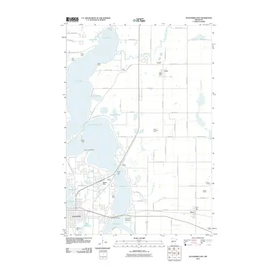
2010 Map of Alexandria East
USGS Topo · Published 2010About this map
The Long Prairie River meanders southward through a glacial landscape defined by its chain of interconnected lakes east of Alexandria. By the early 21st century, the area shows a distinct transition from the urbanized residential developments near Lake Geneva and Lake Victoria to the more rural agricultural tracts in the eastern townships. Small community centers such as Carlos and Nelson maintain their own identities, each anchored by a local post office and cemeteries like Emmanuel Cemetery and Fahlun Cemetery. The proximity of recreational sites, including Hillcrest RV Park, Nordic Trails Golf Course, and Broken Arrow Resort and Campground, highlights the region's enduring character as a destination for seasonal visitors and year-round residents alike. Notable infrastructure such as the Victoria Lake Dam and the K and K Airstrip illustrate the local management of water resources and private aviation within this Douglas County corridor.
Find a feature on this map
77 named features on this map. Tap any name to fly to it.
Don’t see what you’re looking for? This feature index may not catch every label — zoom into the map to look around manually.
Map Details
Editions of this 2010 Alexandria East Map
This is the sole edition of this map. No revisions or reprints were ever made.
Other maps of this area

1953 · Brainerd
USGS Topo · 1:250,000

1953 · Saint Cloud
USGS Topo · 1:250,000

1957 · Brainerd
USGS Topo · 1:250,000

1957 · Saint Cloud
USGS Topo · 1:250,000

1958 · Saint Cloud
USGS Topo · 1:250,000

1958 · Brainerd
USGS Topo · 1:250,000

1965 · Brainerd
USGS Topo · 1:250,000

1966 · Alexandria West
USGS Topo · 1:24,000

1966 · Osakis
USGS Topo · 1:24,000

1966 · Lake Osakis West
USGS Topo · 1:24,000