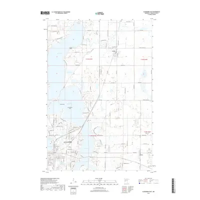
2019 Map of Alexandria East
USGS Topo · Published 2019About this map
Alexandria serves as the focal point of this lake-dominated landscape, where the city’s northeastern expansion meets a complex network of glacial water bodies. The central corridor is defined by the narrow passage between Lake Le Homme Dieu and Lake Geneva, a topographical bottleneck that has historically shaped local transport and development. To the north, the Long Prairie River meanders toward Lake Carlos, anchoring the settlement of Carlos and its nearby Carlos Cem. The map reveals a dense concentration of shoreline residential development, particularly around Kecks Point and Tolena Point, illustrating the transition from the city's grid to the winding recreational roads of the lakefront. Further east, the smaller settlement of Nelson and the Nelson Cem mark a shift toward a more rectilinear agricultural grid, punctuated by local landmarks like Fahlun Cem and Emmanuel Cem.
Find a feature on this map
141 named features on this map. Tap any name to fly to it.
Don’t see what you’re looking for? This feature index may not catch every label — zoom into the map to look around manually.
Map Details
Editions of this 2019 Alexandria East Map
This is the sole edition of this map. No revisions or reprints were ever made.
Other maps of this area

1953 · Brainerd
USGS Topo · 1:250,000

1953 · Saint Cloud
USGS Topo · 1:250,000

1957 · Brainerd
USGS Topo · 1:250,000

1957 · Saint Cloud
USGS Topo · 1:250,000

1958 · Saint Cloud
USGS Topo · 1:250,000

1958 · Brainerd
USGS Topo · 1:250,000

1965 · Brainerd
USGS Topo · 1:250,000

1966 · Alexandria West
USGS Topo · 1:24,000

1966 · Osakis
USGS Topo · 1:24,000

1966 · Lake Osakis West
USGS Topo · 1:24,000