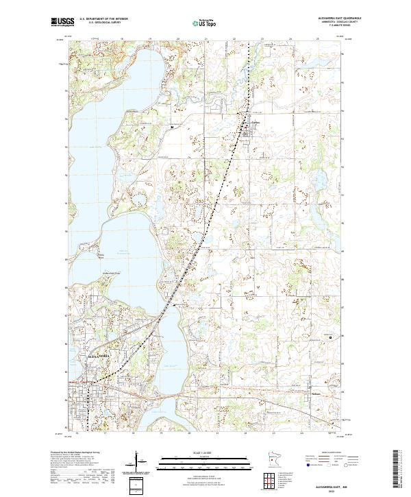
2022 Map of Alexandria East
USGS Topo · Published 2022About this map
Alexandria serves as the focal point for this lake-dominated landscape in Douglas County, where the sprawling waters of Lake Carlos, Lake Geneva, and Lake Victoria define the regional geography. The settlement pattern reflects a deeply integrated relationship with the shoreline, from the residential clusters around Lake Le Homme Dieu to the points of interest like Kecks Point and Government Point. Local history and genealogy are anchored by several distinct burial grounds, including Carlos Prairie Cem, Emmanuel Cem, and Fahlun Cem, scattered across the townships of t129n r37w and t129n r36w. Modern connectivity is illustrated by the Central Lakes State Trl, which provides a recreational corridor through the region, linking the city to the smaller communities of Carlos and Nelson.
Find a feature on this map
65 named features on this map. Tap any name to fly to it.
Don’t see what you’re looking for? This feature index may not catch every label — zoom into the map to look around manually.
Map Details
Editions of this 2022 Alexandria East Map
This is the sole edition of this map. No revisions or reprints were ever made.
Other maps of this area

1953 · Brainerd
USGS Topo · 1:250,000

1953 · Saint Cloud
USGS Topo · 1:250,000

1957 · Brainerd
USGS Topo · 1:250,000

1957 · Saint Cloud
USGS Topo · 1:250,000

1958 · Saint Cloud
USGS Topo · 1:250,000

1958 · Brainerd
USGS Topo · 1:250,000

1965 · Brainerd
USGS Topo · 1:250,000

1966 · Alexandria West
USGS Topo · 1:24,000

1966 · Osakis
USGS Topo · 1:24,000

1966 · Lake Osakis West
USGS Topo · 1:24,000