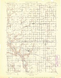
1899 Map of Alexandria
USGS Topo · Published 1899About this map
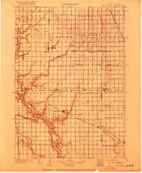
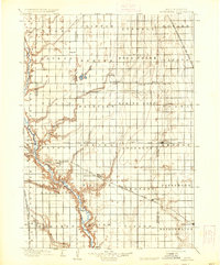
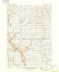
The James River carves a deep, winding valley through the western edge of this prairie landscape, providing a sharp contrast to the rigid township and range grid that dominates the high plains. Surveyed in the mid-1890s, the map reveals a region defined by its burgeoning rail network and agrarian townships like Worthen and Beulah. Four major railroad lines intersect the territory, fueling the growth of small shipping hubs such as Alexandria, Bridgewater, and Spencer. While the rails dictated commerce, local life followed the drainages of Rock Creek and Enemy Creek, where early riverside settlements like Rockport and Elm Spring were established. The map meticulously records the political geography of the time, showing the boundaries between Sanborn, Davison, Miner, and McCook counties during a period of rapid homesteading development.
Find a feature on this map
61 named features on this map. Tap any name to fly to it.
Don’t see what you’re looking for? This feature index may not catch every label — zoom into the map to look around manually.
Map Details
Editions of this 1899 Alexandria Map
5 editions found
Other maps of this area

1898 · Olivet
USGS Topo · 1:125,000

1898 · Parker
USGS Topo · 1:125,000

1898 · Huron
USGS Topo · 1:125,000

1899 · Mitchell
USGS Topo · 1:125,000

1899 · Alexandria
USGS Topo · 1:125,000

1899 · De Smet
USGS Topo · 1:125,000

1953 · Huron
USGS Topo · 1:250,000

1953 · Watertown
USGS Topo · 1:250,000

1954 · Huron
USGS Topo · 1:250,000

1955 · Sioux Falls
USGS Topo · 1:250,000
Featured Places
- Mitchell, SD
- Alexandria, Wayne Township
- Bridgewater, Bridgewater Township
- Emery, Pleasant Township
- Ethan, Rome Township