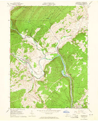
1963 Map of Alexandria
USGS Topo · Published 1965About this map
The Juniata River and its Frankstown Branch carve a complex path through the ridges of Huntingdon County, where the iron-era legacy of the Pennsylvania Railroad dictates the valley's settlement patterns. The map captures the mid-century character of historic boroughs like Alexandria and Petersburg, which are linked by both water and rail. The terrain is dominated by the massive Tussey Mountain and the expansive Rothrock State Forest, where numerous old paths such as the Indian Trail and Rainbow Trail wind through the highlands. Local life is documented through landmarks like the Juniata Valley High School, Bethel Ch, and the subterranean attraction of Lincoln Caverns. Significant industrial and institutional footprints are visible, including a Strip Mine near Warrior Ridge and the State Correctional Institution at the edge of Huntingdon.
Find a feature on this map
62 named features on this map. Tap any name to fly to it.
Don’t see what you’re looking for? This feature index may not catch every label — zoom into the map to look around manually.
Map Details
Editions of this 1963 Alexandria Map
4 editions found
Other maps of this area

1901 · Huntingdon
USGS Topo · 1:62,500

1904 · Huntingdon
USGS Topo · 1:62,500

1919 · Menno
USGS Topo · 1:62,500

1922 · Mt Union
USGS Topo · 1:48,000

1923 · Tyrone
USGS Topo · 1:62,500

1924 · Mt. Union
USGS Topo · 1:62,500

1929 · Tyrone
USGS Topo · 1:48,000

1933 · Tyrone
USGS Topo · 1:62,500

1935 · Allensville
USGS Topo · 1:62,500

1938 · Allensville
USGS Topo · 1:62,500