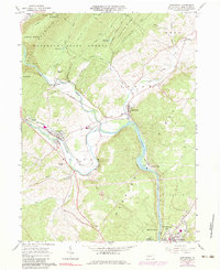
1963 Map of Alexandria
USGS Topo · Published 1983About this map
The Juniata River and its Frankstown Branch dominate this mid-century landscape, where river-valley industry and infrastructure converge. The Penn Central railroad tracks parallel the water, connecting the established boroughs of Alexandria and Petersburg. Evidence of local industrial activity is visible through Brickkilns near Alfarata and a Strip Mine located south of Neff, highlighting the extraction and manufacturing that supported these communities.
Find a feature on this map
60 named features on this map. Tap any name to fly to it.
Don’t see what you’re looking for? This feature index may not catch every label — zoom into the map to look around manually.
Map Details
Editions of this 1963 Alexandria Map
4 editions found
Other maps of this area

1901 · Huntingdon
USGS Topo · 1:62,500

1904 · Huntingdon
USGS Topo · 1:62,500

1919 · Menno
USGS Topo · 1:62,500

1922 · Mt Union
USGS Topo · 1:48,000

1923 · Tyrone
USGS Topo · 1:62,500

1924 · Mt. Union
USGS Topo · 1:62,500

1929 · Tyrone
USGS Topo · 1:48,000

1933 · Tyrone
USGS Topo · 1:62,500

1935 · Allensville
USGS Topo · 1:62,500

1938 · Allensville
USGS Topo · 1:62,500