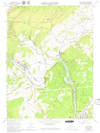
1963 Map of Alexandria
USGS Topo · Published 1980About this map
The Juniata River and its Frankstown Branch dominate this central Pennsylvania landscape, carving deep valleys between the prominent ridges of Spruce Creek Mountain and Warrior Ridge. The 1960s era was defined by the transition from steam to diesel rail, as seen in the prominent Penn Central line that snakes along the riverbanks, connecting the boroughs of Alexandria and Petersburg. These settlements developed at strategic water junctions, where smaller tributaries like Spruce Creek and Shaver Creek meet the main river channel.
Find a feature on this map
52 named features on this map. Tap any name to fly to it.
Don’t see what you’re looking for? This feature index may not catch every label — zoom into the map to look around manually.
Map Details
Editions of this 1963 Alexandria Map
4 editions found
Other maps of this area

1901 · Huntingdon
USGS Topo · 1:62,500

1904 · Huntingdon
USGS Topo · 1:62,500

1919 · Menno
USGS Topo · 1:62,500

1922 · Mt Union
USGS Topo · 1:48,000

1923 · Tyrone
USGS Topo · 1:62,500

1924 · Mt. Union
USGS Topo · 1:62,500

1929 · Tyrone
USGS Topo · 1:48,000

1933 · Tyrone
USGS Topo · 1:62,500

1935 · Allensville
USGS Topo · 1:62,500

1938 · Allensville
USGS Topo · 1:62,500