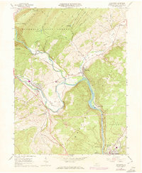
1963 Map of Alexandria
USGS Topo · Published 1973About this map
Penn Central rail lines and the winding waters of the Juniata River define the local geography of central Pennsylvania in the early 1960s. The convergence of the Frankstown Branch Juniata River and the main channel anchors the settlements of Alexandria, Petersburg, and Barree. This topographic study reveals the industrial and recreational character of the land, from the Strip Mine located south of Neff to the cavernous geology of Lincoln Caverns.
Find a feature on this map
57 named features on this map. Tap any name to fly to it.
Don’t see what you’re looking for? This feature index may not catch every label — zoom into the map to look around manually.
Map Details
Editions of this 1963 Alexandria Map
4 editions found
Other maps of this area

1901 · Huntingdon
USGS Topo · 1:62,500

1904 · Huntingdon
USGS Topo · 1:62,500

1919 · Menno
USGS Topo · 1:62,500

1922 · Mt Union
USGS Topo · 1:48,000

1923 · Tyrone
USGS Topo · 1:62,500

1924 · Mt. Union
USGS Topo · 1:62,500

1929 · Tyrone
USGS Topo · 1:48,000

1933 · Tyrone
USGS Topo · 1:62,500

1935 · Allensville
USGS Topo · 1:62,500

1938 · Allensville
USGS Topo · 1:62,500