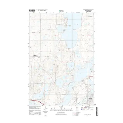
2016 Map of Alexandria West
USGS Topo · Published 2016About this map
Glacial lakes and wetlands dominate this 2016 survey of Douglas County, revealing the complex water systems west of Alexandria. The landscape is defined by large bodies of water like Lake Ida and Lake Latoka, which are separated by narrow peninsulas such as Breezy Point and Pilgrim Point. In the northwestern corner, the village of Garfield sits at the intersection of local routes near Saint Johns Cem, while the eastern portion of the map shows the suburban expansion of Alexandria toward Lake Henry and Lake Winona.
Find a feature on this map
139 named features on this map. Tap any name to fly to it.
Don’t see what you’re looking for? This feature index may not catch every label — zoom into the map to look around manually.
Map Details
Editions of this 2016 Alexandria West Map
This is the sole edition of this map. No revisions or reprints were ever made.
Other maps of this area

1953 · Brainerd
USGS Topo · 1:250,000

1953 · Saint Cloud
USGS Topo · 1:250,000

1957 · Brainerd
USGS Topo · 1:250,000

1957 · Saint Cloud
USGS Topo · 1:250,000

1958 · Saint Cloud
USGS Topo · 1:250,000

1958 · Brainerd
USGS Topo · 1:250,000

1965 · Brainerd
USGS Topo · 1:250,000

1966 · Brandon
USGS Topo · 1:24,000

1966 · Alexandria West
USGS Topo · 1:24,000

1966 · Farwell
USGS Topo · 1:24,000