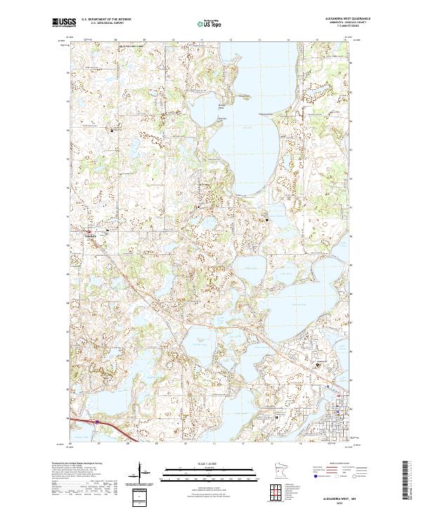
2022 Map of Alexandria West
USGS Topo · Published 2022About this map
Glacial lakes dominate this portion of Douglas County, where the village of Garfield sits as a central hub west of the county seat. The landscape is defined by an intricate network of interconnected waters, including the expansive Lake Ida and the clustered shores of Lake Darling, Lake Cowdry, and Lake Latoka. These water bodies are punctuated by distinctive landforms such as Stony Point and Breezy Point, which reflect the long-standing recreational and residential draw of the region.
Find a feature on this map
178 named features on this map. Tap any name to fly to it.
Don’t see what you’re looking for? This feature index may not catch every label — zoom into the map to look around manually.
Map Details
Editions of this 2022 Alexandria West Map
This is the sole edition of this map. No revisions or reprints were ever made.
Other maps of this area

1953 · Brainerd
USGS Topo · 1:250,000

1953 · Saint Cloud
USGS Topo · 1:250,000

1957 · Brainerd
USGS Topo · 1:250,000

1957 · Saint Cloud
USGS Topo · 1:250,000

1958 · Saint Cloud
USGS Topo · 1:250,000

1958 · Brainerd
USGS Topo · 1:250,000

1965 · Brainerd
USGS Topo · 1:250,000

1966 · Brandon
USGS Topo · 1:24,000

1966 · Alexandria West
USGS Topo · 1:24,000

1966 · Farwell
USGS Topo · 1:24,000