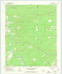
1962 Map of Alikchi
USGS Topo · Published 1975About this map
The Little River winds through the southwestern corner of this 1962 landscape, marking a topographical transition where the bottomlands meet the rising timbered hills. Near the river, the settlement of Ringold stands as a focal point of local activity, while further east, the small community of Alikchi is situated near a prominent Spring. These rural hubs are connected by a network of unimproved roads and fence lines that trace the homesteads of the early 1960s.
Find a feature on this map
22 named features on this map. Tap any name to fly to it.
Don’t see what you’re looking for? This feature index may not catch every label — zoom into the map to look around manually.
Map Details
Editions of this 1962 Alikchi Map
3 editions found
Other maps of this area

1901 · Alikchi
USGS Topo · 1:125,000

1902 · Lukfata
USGS Topo · 1:125,000

1950 · Mcalester
USGS Topo · 1:250,000

1959 · Golden
USGS Topo · 1:62,500

1960 · Bethel
USGS Topo · 1:62,500

1962 · McAlester
USGS Topo · 1:250,000

1962 · Wright City
USGS Topo · 1:24,000

1962 · Sobol
USGS Topo · 1:24,000

1962 · Caney Mountain
USGS Topo · 1:24,000

1962 · Alikchi
USGS Topo · 1:24,000