Loading...
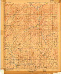
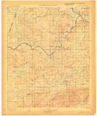
Loading map...1901 Map of Alikchi
USGS Topo · Published 1915About this map
Old Spencer Academy and Oak Hill Academy stand as central landmarks in this Choctaw Nation landscape, documented by surveyors C.F. Urquhart and W.B. Corse just before the turn of the century. The terrain is defined by the winding paths of the Kiamichi River and the Little River, where river crossings like Rook Chimney Ferry provided vital transit points in a region without rail infrastructure.
Find a feature on this map
32 named features on this map. Tap any name to fly to it.
Don’t see what you’re looking for? This feature index may not catch every label — zoom into the map to look around manually.
Map Details
Date Portrayed1901
Date Published1915
PublisherU.S. Geological Survey
Map TypeTopographic
Scale1:125,000
Physical Dimensions16.7 x 20 inches
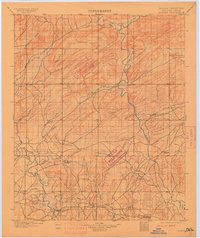
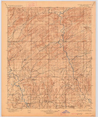
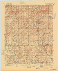
Editions of this 1901 Alikchi Map
5 editions found

Historical Maps of Hugo Through Time

Featured Locations
Source Details
SourceU.S. Geological Survey
CopyrightPublic Domain