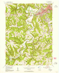
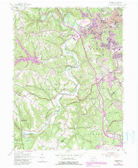
1954 Map of Aliquippa
USGS Topo · Published 1955About this map
Aliquippa serves as the industrial and residential anchor of this mid-century landscape, showing the dense urban footprint and landmark buildings of the city alongside the Woodlawn Dam and Aliquippa Airport. The terrain quickly transitions from the concentrated development of New Sheffield and Scottsville into the deeply dissected hills of Hopewell and Independence townships. Here, the landscape is defined by the winding course of Raccoon Creek and its many tributaries like Service Creek and Logtown Run.
Find a feature on this map
48 named features on this map. Tap any name to fly to it.
Don’t see what you’re looking for? This feature index may not catch every label — zoom into the map to look around manually.
Map Details
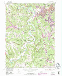
Editions of this 1954 Aliquippa Map
6 editions found
Other maps of this area

1901 · Beaver
USGS Topo · 1:62,500

1904 · Beaver
USGS Topo · 1:62,500

1904 · Carnegie
USGS Topo · 1:62,500

1904 · Burgettstown
USGS Topo · 1:62,500

1906 · Burgettstown
USGS Topo · 1:62,500

1906 · Carnegie
USGS Topo · 1:62,500

1906 · Sewickley
USGS Topo · 1:62,500

1908 · Sewickley
USGS Topo · 1:62,500

1908 · Carnegie
USGS Topo · 1:62,500

1951 · Canton
USGS Topo · 1:250,000
Featured Places
- Moon Township, PA
- Center Township, PA
- Aliquippa, PA
- Independence Township, PA
- Bocktown, Independence Township