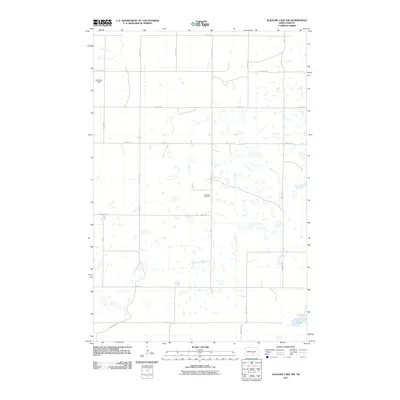
2011 Map of Alkaline Lake NW
USGS Topo · Published 2011About this map
Glueckstal Cemetery stands as a primary landmark in this section of Logan County, signaling the area's deep ties to the German-Russian heritage of North Dakota's homesteaders. This high-plains landscape is defined by its characteristic prairie pothole topography, where hundreds of small, scattered wetlands dot the section lines. The rural infrastructure follows a rigid cardinal grid, with long stretches such as 35th Ave SE and 48th St SE connecting isolated agricultural operations. In the northwestern corner, Nicholson Field serves the local farming community, while the southeastern corner is anchored by the waters of Fresh Lake. The map reveals a region focused on large-scale cultivation and grazing, where the preservation of small family or community burying grounds provides the main physical link to the early 20th-century settlement era.
Find a feature on this map
17 named features on this map. Tap any name to fly to it.
Don’t see what you’re looking for? This feature index may not catch every label — zoom into the map to look around manually.
Map Details
Editions of this 2011 Alkaline Lake NW Map
This is the sole edition of this map. No revisions or reprints were ever made.
Other maps of this area

1952 · Tappen South
USGS Topo · 1:24,000

1952 · Tappen SE
USGS Topo · 1:24,000

1952 · Dawson
USGS Topo · 1:24,000

1953 · Jamestown
USGS Topo · 1:250,000

1956 · Jamestown
USGS Topo · 1:250,000

1979 · Kintyre NE
USGS Topo · 1:24,000

1980 · McKenna Lake North
USGS Topo · 1:24,000

1983 · Alkaline Lake SW
USGS Topo · 1:24,000

1983 · Alkaline Lake
USGS Topo · 1:24,000

1983 · Alkaline Lake NW
USGS Topo · 1:24,000