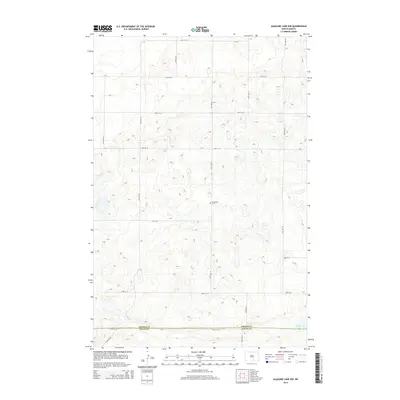
2014 Map of Alkaline Lake NW
USGS Topo · Published 2014About this map
Glueckstal Cem sits at the heart of this landscape, a lone landmark in a prairie defined by pothole lakes and section-line roads. This survey of the borderlands between Kidder and Logan Counties shows the persistent grid of rural infrastructure, with routes like 46th St SE and 37th Ave SE carving through the glaciated terrain. The hydrology of the area is characterized by numerous unnamed seasonal wetlands and the permanent waters of Fresh Lake in the southeast corner. The presence of the cemetery suggests the historical footprint of German-Russian settlement patterns common to this portion of North Dakota, where isolated rural communities centered their social and religious life around such focal points. The map provides a detailed view of the subtle elevation changes and the countless small depressions that fill with water in this unique prairie environment.
Find a feature on this map
18 named features on this map. Tap any name to fly to it.
Don’t see what you’re looking for? This feature index may not catch every label — zoom into the map to look around manually.
Map Details
Editions of this 2014 Alkaline Lake NW Map
This is the sole edition of this map. No revisions or reprints were ever made.
Other maps of this area

1952 · Tappen South
USGS Topo · 1:24,000

1952 · Tappen SE
USGS Topo · 1:24,000

1952 · Dawson
USGS Topo · 1:24,000

1953 · Jamestown
USGS Topo · 1:250,000

1956 · Jamestown
USGS Topo · 1:250,000

1979 · Kintyre NE
USGS Topo · 1:24,000

1980 · McKenna Lake North
USGS Topo · 1:24,000

1983 · Alkaline Lake SW
USGS Topo · 1:24,000

1983 · Alkaline Lake
USGS Topo · 1:24,000

1983 · Alkaline Lake NW
USGS Topo · 1:24,000