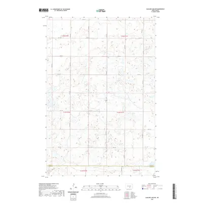
2020 Map of Alkaline Lake NW
USGS Topo · Published 2020About this map
The rolling prairie landscape along the Kidder Co Logan Co boundary is defined by a dense network of seasonal wetlands and small basins typical of the Missouri Coteau region. Near the center of this landscape lies the Glueckstal Cem, a significant marker of the German-Russian heritage that shaped this part of North Dakota. The area's settlement pattern is reflected in a precise grid of section-line roads, including 46th St SE and 37th Ave SE, which navigate around numerous depressions. In the southeastern corner, the presence of Fresh Lake provides one of the few permanent water bodies amidst the myriad small potholes and marshes. This map captures a rural environment where land use remains closely tied to the natural topography and the historical township divisions of the Public Land Survey System.
Find a feature on this map
23 named features on this map. Tap any name to fly to it.
Don’t see what you’re looking for? This feature index may not catch every label — zoom into the map to look around manually.
Map Details
Editions of this 2020 Alkaline Lake NW Map
This is the sole edition of this map. No revisions or reprints were ever made.
Other maps of this area

1952 · Tappen South
USGS Topo · 1:24,000

1952 · Tappen SE
USGS Topo · 1:24,000

1952 · Dawson
USGS Topo · 1:24,000

1953 · Jamestown
USGS Topo · 1:250,000

1956 · Jamestown
USGS Topo · 1:250,000

1979 · Kintyre NE
USGS Topo · 1:24,000

1980 · McKenna Lake North
USGS Topo · 1:24,000

1983 · Alkaline Lake SW
USGS Topo · 1:24,000

1983 · Alkaline Lake
USGS Topo · 1:24,000

1983 · Alkaline Lake NW
USGS Topo · 1:24,000