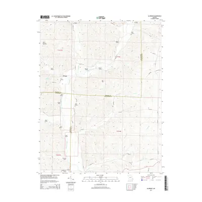
2015 Map of Allbright
USGS Topo · Published 2015About this map
The Saint Francois Mountains frame this corner of southeast Missouri, where the settlement of Allbright serves as a central point in a landscape defined by deep hollows and high ridges. The map records a significant concentration of family and community burial grounds, including Rickman Cemetery, Blaylock Cemetery, and Moores Chapel Cemetery, which are scattered throughout the hills. These sites, along with others like Rhodes Cemetery and Kinder Chapel Cemetery, provide vital geographic markers for those researching the early residents of Madison, Wayne, and Bollinger counties.
Find a feature on this map
39 named features on this map. Tap any name to fly to it.
Don’t see what you’re looking for? This feature index may not catch every label — zoom into the map to look around manually.
Map Details
Editions of this 2015 Allbright Map
This is the sole edition of this map. No revisions or reprints were ever made.
Other maps of this area

1930 · Coldwater
USGS Topo · 1:62,500

1933 · Marquand
USGS Topo · 1:62,500

1934 · Greenville
USGS Topo · 1:62,500

1935 · Zalma
USGS Topo · 1:62,500

1938 · Marquand
USGS Topo · 1:62,500

1939 · Greenville
USGS Topo · 1:62,500

1939 · Zalma
USGS Topo · 1:62,500

1949 · Rolla
USGS Topo · 1:250,000

1949 · Coldwater
USGS Topo · 1:62,500

1953 · Rolla
USGS Topo · 1:250,000