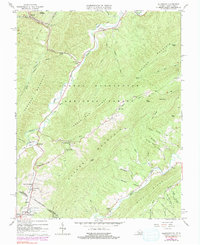
1966 Map of Allegany
USGS Topo · Published 1991About this map
Alleghany and the surrounding mountain ridges sit along the border of Virginia and West Virginia during the mid-1960s, defined by a landscape of isolated valleys and deep railway engineering. The Chesapeake and Ohio railroad threads through the northern reaches of the map, marked by the significant Lewis Tunnel and its namesake Lewis Tunnel Cem. This region is characterized by historical mineral springs and small gaps in the George Washington National Forest, including the community of Sweet Springs and the nearby Sweet Chalybeate. Resource extraction and rural life are evidenced by the Iron Hill Springs and various isolated churches such as Palestine Ch and Sugar Valley Ch. The terrain transitions from the heights of Peters Mountain down to the winding waters of Dunlap Creek, where small settlements like Crows and Hematite persist along the winding road and rail corridors.
Find a feature on this map
70 named features on this map. Tap any name to fly to it.
Don’t see what you’re looking for? This feature index may not catch every label — zoom into the map to look around manually.
Map Details
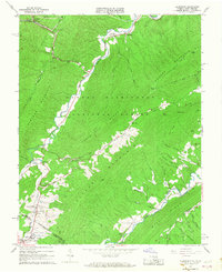
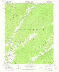
Editions of this 1966 Allegany Map
Other maps of this area

1887 · Lewisburg
USGS Topo · 1:125,000

1891 · Lewisburg
USGS Topo · 1:125,000

1921 · Callaghan
USGS Topo · 1:48,000

1921 · White Sulphur Springs
USGS Topo · 1:48,000

1921 · Ronceverte
USGS Topo · 1:48,000

1923 · White Sulphur Springs
USGS Topo · 1:62,500

1923 · Ronceverte
USGS Topo · 1:62,500

1923 · Callaghan
USGS Topo · 1:62,500

1935 · White Sulphur Springs
USGS Topo · 1:62,500

1939 · White Sulphur Springs
USGS Topo · 1:62,500