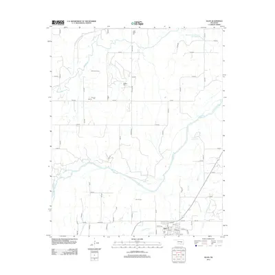
2012 Map of Allen
USGS Topo · Published 2012About this map
The town of Allen serves as the focal point for this 2012 survey, situated amidst a landscape shaped by petroleum extraction and major river systems. The Canadian River meanders across the southern half of the quadrangle, while the Little River cuts through the northwest corner near Little River Hill. This area is heavily influenced by energy production, as evidenced by the large Holdenville Oil Field and Allen Oil Field, which dominate the central and northern sections of the map. Genealogists will find several burial sites noted, including Allen Cem, Tiger Cem, and Greenleaf Cem. The rugged topography of the region is punctuated by elevations like Osage Hill, while water resources like Arbeca Cr and the Wemer-Leonard Company Lake Number 1 support the surrounding rural infrastructure. The map illustrates a grid of county roads that connect these industrial and historical sites, reflecting the ongoing intersection of natural resources and local community life.
Find a feature on this map
55 named features on this map. Tap any name to fly to it.
Don’t see what you’re looking for? This feature index may not catch every label — zoom into the map to look around manually.
Map Details
Editions of this 2012 Allen Map
This is the sole edition of this map. No revisions or reprints were ever made.
Other maps of this area

1896 · Seminole and Prague
USGS Topo · 1:125,000

1896 · Coalgate
USGS Topo · 1:125,000

1899 · Coalgate
USGS Topo · 1:125,000

1900 · Wewoka
USGS Topo · 1:125,000

1900 · Coalgate
USGS Topo · 1:125,000

1901 · Stonewall
USGS Topo · 1:125,000

1954 · Oklahoma City
USGS Topo · 1:250,000

1957 · Ardmore
USGS Topo · 1:250,000

1957 · Oklahoma City
USGS Topo · 1:250,000

1958 · Sasakwa
USGS Topo · 1:24,000