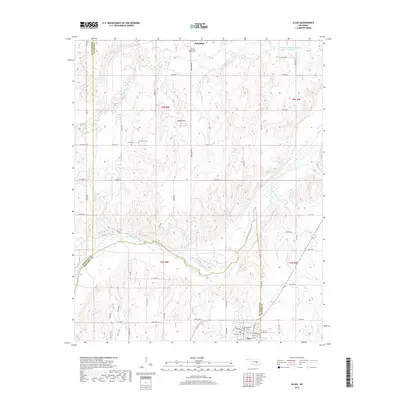
2018 Map of Allen
USGS Topo · Published 2018About this map
The town of Allen serves as the focal point of this landscape, situated at the junction of three Oklahoma counties. The terrain is defined by the significant southward curve of the Canadian River, which forms the boundary between Seminole and Pontotoc counties. To the north, Little River meanders toward the northeast, flanked by elevated landmarks like Little River Hill and Osage Hill. This area highlights the transition between river bottomlands and upland ridges, with the rural character maintained through a network of section line roads such as EW140 Rd. Local history is anchored by several burial sites, including Tiger Cem, Greenleaf Cem, and Allen Cem, which provide valuable touchstones for genealogical research. Smaller drainages like Arbeca Cr and Little Sandy Cr dissect the plains, while the Werner-Leonard Company Lake Number 1 represents localized water management in the northern reaches near Spaulding.
Find a feature on this map
38 named features on this map. Tap any name to fly to it.
Don’t see what you’re looking for? This feature index may not catch every label — zoom into the map to look around manually.
Map Details
Editions of this 2018 Allen Map
This is the sole edition of this map. No revisions or reprints were ever made.
Other maps of this area

1896 · Seminole and Prague
USGS Topo · 1:125,000

1896 · Coalgate
USGS Topo · 1:125,000

1899 · Coalgate
USGS Topo · 1:125,000

1900 · Wewoka
USGS Topo · 1:125,000

1900 · Coalgate
USGS Topo · 1:125,000

1901 · Stonewall
USGS Topo · 1:125,000

1954 · Oklahoma City
USGS Topo · 1:250,000

1957 · Ardmore
USGS Topo · 1:250,000

1957 · Oklahoma City
USGS Topo · 1:250,000

1958 · Sasakwa
USGS Topo · 1:24,000