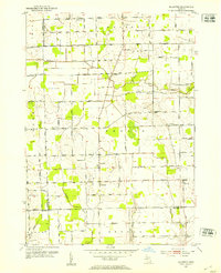
1952 Map of Allenton
USGS Topo · Published 1953About this map
Allenton serves as a central hub in this agricultural landscape of the early 1950s, situated at the crossroads of Almont Road and Capac Road. The map documents a well-distributed network of rural education and community life, featuring numerous one-room schoolhouses like Lockbridge Sch and Gould Sch, alongside local landmarks such as West Berlin Ch. The terrain is defined by the winding course of the Belle River in the north and the Coon Creek system to the south, which dictated the placement of early settlements and drainage works like the Newland Drain. Genealogists will find significant value in the clearly marked burial grounds, including the Scotch Settlement Cem and Rose Hill Cem, which anchor the histories of the various townships—Berlin, Mussey, and Bruce—that converge in this multi-county border region.
Find a feature on this map
59 named features on this map. Tap any name to fly to it.
Don’t see what you’re looking for? This feature index may not catch every label — zoom into the map to look around manually.
Map Details
Editions of this 1952 Allenton Map
2 editions found
Other maps of this area

1914 · Armada
USGS Topo · 1:62,500

1928 · Armada
USGS Topo · 1:62,500

1943 · Romeo
USGS Topo · 1:24,000

1944 · Memphis
USGS Topo · 1:24,000

1945 · Armada
USGS Topo · 1:24,000

1945 · Almont
USGS Topo · 1:24,000

1945 · Allenton
USGS Topo · 1:24,000

1945 · Richmond
USGS Topo · 1:24,000

1945 · Romeo
USGS Topo · 1:24,000

1952 · Allenton
USGS Topo · 1:24,000