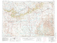
1955 Map of Alliance
USGS Topo · Published 1981About this map
The Nebraska National Forest and the rugged escarpment of the Pine Ridge dominate the northern terrain of this Nebraska Panhandle survey. Centered on the hub of Alliance, the map details a landscape transitioning from the dramatic bluffs near Chadron and Crawford to the expansive Sand Hills of the southeast. The historic grounds of Fort Robinson and the nearby Fort Robinson Beef Cattle Research Station occupy a significant portion of the western territory, illustrating the area's deep ties to frontier military history and subsequent agricultural science.
Find a feature on this map
66 named features on this map. Tap any name to fly to it.
Don’t see what you’re looking for? This feature index may not catch every label — zoom into the map to look around manually.
Map Details
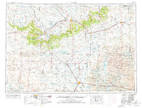
Editions of this 1955 Alliance Map
3 editions found

Other maps of this area

1896 · Oelrichs
USGS Topo · 1:125,000

1896 · Patrick
USGS Topo · 1:125,000

1896 · Browns Creek
USGS Topo · 1:125,000

1898 · Scotts Bluff
USGS Topo · 1:125,000

1898 · Camp Clarke
USGS Topo · 1:125,000

1899 · Browns Creek
USGS Topo · 1:125,000

1899 · Goshen Hole
USGS Topo · 1:125,000

1899 · Whistle Creek
USGS Topo · 1:125,000

1900 · Oelrichs
USGS Topo · 1:125,000

1902 · Edgemont
USGS Topo · 1:125,000