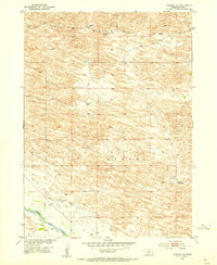
1952 Map of Almeria NE
USGS Topo · Published 1954About this map
North Loup River flows through the southwestern corner of this 1952 Nebraska landscape, defining a narrow corridor of water and activity in an otherwise high-country terrain. The presence of an Abandoned Canal running parallel to the river suggests early attempts at irrigation and water management that had already fallen out of use by the mid-century. This area of Loup County is characterized by distinctive named terrain such as Bloody and Strohl, which hint at the local ranching and settlement history of the region.
Find a feature on this map
9 named features on this map. Tap any name to fly to it.
Don’t see what you’re looking for? This feature index may not catch every label — zoom into the map to look around manually.
Map Details
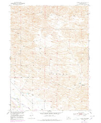
Editions of this 1952 Almeria NE Map
3 editions found
Other maps of this area

1952 · Taylor NW
USGS Topo · 1:24,000

1952 · Almeria NE
USGS Topo · 1:24,000

1952 · Almeria NW
USGS Topo · 1:24,000

1952 · Almeria SW
USGS Topo · 1:24,000

1952 · Almeria
USGS Topo · 1:24,000

1952 · Taylor
USGS Topo · 1:24,000

1955 · Broken Bow
USGS Topo · 1:250,000

1955 · O'Neill
USGS Topo · 1:250,000

1956 · Broken Bow
USGS Topo · 1:250,000

1959 · O'Neill
USGS Topo · 1:250,000