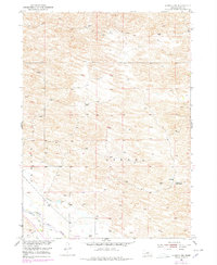
1952 Map of Almeria NE
USGS Topo · Published 1978About this map
The North Loup River winds through the southwestern corner of this Nebraska landscape, where the presence of an Abandoned Canal and School No 32 (Abandoned) points to shifting patterns of settlement and land use in Loup County. The topography is dominated by the sandhills-style terrain of Bloody and Strohl, characterized by intricate contours and numerous windmills essential for cattle ranching. In the river valley, a small Landing Strip and the broad Dry Valley suggest the region's agricultural and transportation infrastructure mid-century. This survey, updated with 1970s aerial photography, captures the intersection of early irrigation attempts and the enduring cattle industry in this part of the Nebraska interior.
Find a feature on this map
9 named features on this map. Tap any name to fly to it.
Don’t see what you’re looking for? This feature index may not catch every label — zoom into the map to look around manually.
Map Details
Editions of this 1952 Almeria NE Map
3 editions found
Other maps of this area

1952 · Taylor NW
USGS Topo · 1:24,000

1952 · Almeria NE
USGS Topo · 1:24,000

1952 · Almeria NW
USGS Topo · 1:24,000

1952 · Almeria SW
USGS Topo · 1:24,000

1952 · Almeria
USGS Topo · 1:24,000

1952 · Taylor
USGS Topo · 1:24,000

1955 · Broken Bow
USGS Topo · 1:250,000

1955 · O'Neill
USGS Topo · 1:250,000

1956 · Broken Bow
USGS Topo · 1:250,000

1959 · O'Neill
USGS Topo · 1:250,000