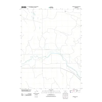
2011 Map of Almeria NW
USGS Topo · Published 2011About this map
The North Loup River winds through this section of Loup County, defining the drainage patterns and valley structure of the Nebraska landscape. This area is characterized by large agricultural and ranching holdings, notably the Peterson Ranch located in the northern reaches of the quadrangle. The map captures the organized rural road network that facilitates movement through the valley, with named routes like Pleasant Valley Rd and W End Rd following the natural contours of the river basin. County roads such as Co Rd 6 and Co Rd 1-22 provide a grid-like framework connecting the more isolated ranch properties to the primary east-west corridors. This 2011 survey reflects the enduring cattle-ranching and farming tradition of the region, where the river remains the central geographic feature and primary resource for the local economy.
Find a feature on this map
7 named features on this map. Tap any name to fly to it.
Don’t see what you’re looking for? This feature index may not catch every label — zoom into the map to look around manually.
Map Details
Editions of this 2011 Almeria NW Map
This is the sole edition of this map. No revisions or reprints were ever made.
Other maps of this area

1952 · Brewster
USGS Topo · 1:24,000

1952 · Almeria NE
USGS Topo · 1:24,000

1952 · Almeria NW
USGS Topo · 1:24,000

1952 · Almeria SW
USGS Topo · 1:24,000

1952 · Brewster SE
USGS Topo · 1:24,000

1952 · Almeria
USGS Topo · 1:24,000

1955 · Broken Bow
USGS Topo · 1:250,000

1955 · O'Neill
USGS Topo · 1:250,000

1956 · Broken Bow
USGS Topo · 1:250,000

1959 · O'Neill
USGS Topo · 1:250,000