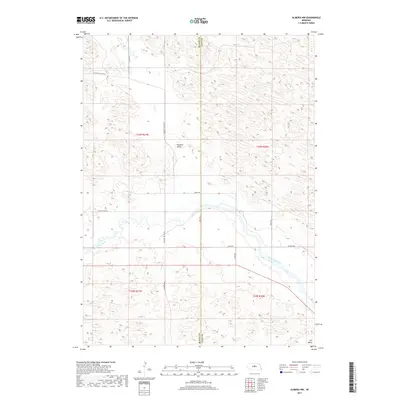
2017 Map of Almeria NW
USGS Topo · Published 2017About this map
North Loup River meanders across the center of this Nebraska landscape, defining the transition between the agricultural river valley and the more irregular terrain to the north and south. The settlement patterns reflect a sparse, ranching-oriented layout, with established locales like Pleasant Valley and Dry Valley situated away from the immediate riverbanks. A network of rural routes, including Pleasant Valley Rd and Worth Rd, connects these remote valleys across the county line between Blaine and Loup counties. This survey documents the intersection of public land survey systems and local topography, where the grid of sections and ranges is occasionally interrupted by the natural course of the river and the complex contours of the surrounding hills.
Find a feature on this map
17 named features on this map. Tap any name to fly to it.
Don’t see what you’re looking for? This feature index may not catch every label — zoom into the map to look around manually.
Map Details
Editions of this 2017 Almeria NW Map
This is the sole edition of this map. No revisions or reprints were ever made.
Other maps of this area

1952 · Brewster
USGS Topo · 1:24,000

1952 · Almeria NE
USGS Topo · 1:24,000

1952 · Almeria NW
USGS Topo · 1:24,000

1952 · Almeria SW
USGS Topo · 1:24,000

1952 · Brewster SE
USGS Topo · 1:24,000

1952 · Almeria
USGS Topo · 1:24,000

1955 · Broken Bow
USGS Topo · 1:250,000

1955 · O'Neill
USGS Topo · 1:250,000

1956 · Broken Bow
USGS Topo · 1:250,000

1959 · O'Neill
USGS Topo · 1:250,000