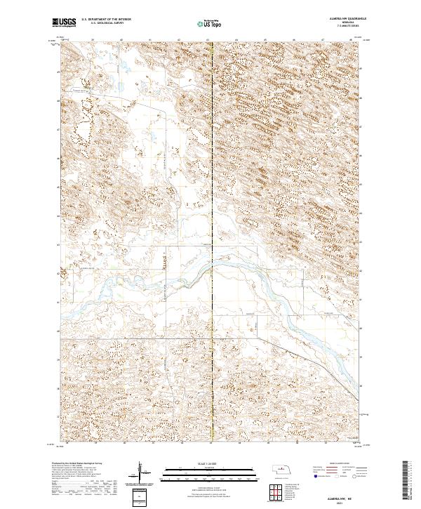
2021 Map of Almeria NW
USGS Topo · Published 2021About this map
The North Loup River meanders across this Central Nebraska landscape, cutting a distinct valley through the sandhills of the Great Plains. This 2021 survey reveals a sparsely populated agricultural region defined by large sections of the Public Land Survey System, including t23n r21w and t22n r20w. The terrain is characterized by the complex contour patterns of the Nebraska Sandhills, with the notable depression of Dry Valley situated in the southeastern corner. A network of rural section-line roads, such as Pleasant Valley Rd and E Milburn Rd, provides the primary infrastructure for the area's ranching and farming operations. The border between Blaine County and Loup County bisects the quadrangle, illustrating the political boundaries that overlay this undulating natural topography.
Find a feature on this map
16 named features on this map. Tap any name to fly to it.
Don’t see what you’re looking for? This feature index may not catch every label — zoom into the map to look around manually.
Map Details
Editions of this 2021 Almeria NW Map
This is the sole edition of this map. No revisions or reprints were ever made.
Other maps of this area

1952 · Brewster
USGS Topo · 1:24,000

1952 · Almeria NE
USGS Topo · 1:24,000

1952 · Almeria NW
USGS Topo · 1:24,000

1952 · Almeria SW
USGS Topo · 1:24,000

1952 · Brewster SE
USGS Topo · 1:24,000

1952 · Almeria
USGS Topo · 1:24,000

1955 · Broken Bow
USGS Topo · 1:250,000

1955 · O'Neill
USGS Topo · 1:250,000

1956 · Broken Bow
USGS Topo · 1:250,000

1959 · O'Neill
USGS Topo · 1:250,000