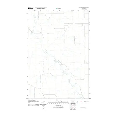
2011 Map of Almont East
USGS Topo · Published 2011About this map
Big Muddy Creek meanders through this portion of Morton County, creating a complex series of oxbows and bends that dominate the central and southern landscape. The terrain is defined by the winding paths of these waterways, including Hailstone Creek in the northwest, which drain an area primarily organized by a rigid grid of rural roads and section lines. For genealogists and local historians, the Almont Cemetery serves as a significant landmark, situated near the intersection of Sims Rd and 48th St. The road network, including County Hwy 137 and Valley Rd, illustrates the intersection of natural topography and agricultural land division, where routes frequently deviate from the grid to follow the natural contours of the creek valleys.
Find a feature on this map
21 named features on this map. Tap any name to fly to it.
Don’t see what you’re looking for? This feature index may not catch every label — zoom into the map to look around manually.
Map Details
Editions of this 2011 Almont East Map
This is the sole edition of this map. No revisions or reprints were ever made.
Other maps of this area

1954 · Bismarck
USGS Topo · 1:250,000

1958 · Bismarck
USGS Topo · 1:250,000

1960 · North Almont
USGS Topo · 1:24,000

1960 · New Salem
USGS Topo · 1:24,000

1970 · Judson
USGS Topo · 1:24,000

1980 · Otter Creek West
USGS Topo · 1:24,000

1980 · Green Ridge
USGS Topo · 1:24,000

1980 · Otter Creek East
USGS Topo · 1:24,000

1980 · Crown Butte Creek SE
USGS Topo · 1:24,000

1980 · Almont East
USGS Topo · 1:24,000