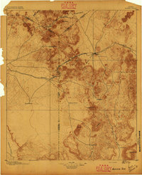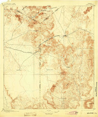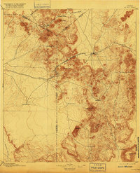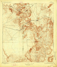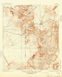
1895 Map of Alpine
USGS Topo · Published 1904About this map
Mitre Peak and the high desert ranges of the Trans-Pecos dominate this military-focused survey, which documents the essential logistical landscape of the Alpine region during a period of transition. The cattle industry is prominently represented through several Stock Yards and large ranching operations like those of Jackson & Harman, Kokernot, and Votaw & Carnes. The arrival of the Southern Pacific R. R. transformed the local economy, while the Kansas City Mexico and Orient R. R. is shown as under construction, signaling further expansion. Detailed military reconnaissance notes identify strategic assets such as the Powder Magazine and various troop encampment sites. Industrial activity is grounded in the Jordan Marble Quarry and several named springs and wells, which were vital for survival and transport in this arid West Texas environment.
Find a feature on this map
102 named features on this map. Tap any name to fly to it.
Don’t see what you’re looking for? This feature index may not catch every label — zoom into the map to look around manually.
Map Details
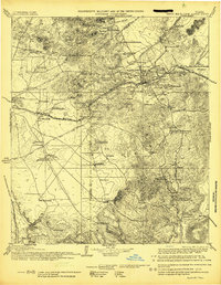
Editions of this 1895 Alpine Map
6 editions found