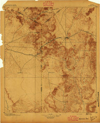
1895 Map of Alpine
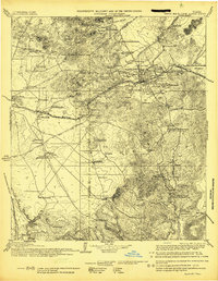
USGS Topo · Published 1949About this map
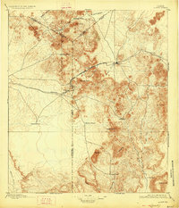
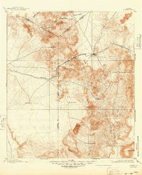
Alpine serves as the central hub of this West Texas landscape, where the Galveston Harrisburg and San Antonio Div. and Southern Pacific railroads converge. Surveyed in 1893 by Chas F. Urquhart, the map reveals a region defined by high-elevation cattle ranching and crucial rail stops such as Toronto and Strobel. The terrain is dominated by prominent volcanic features and peaks, including the striking Mitre Peak, the high crest of Mt. Ord, and Elephant Mt. to the southeast. Numerous family-named homesteads like Walbridge Ranch and Mc.Intire Ranch are scattered across the draws and canyons, illustrating the early settlement patterns in the tri-county area of Jeff Davis, Presidio, and Brewster. Significant watercourses such as Calamity Creek and Alamito Creek cut through the arid basins, tracing the natural drainage towards the southern borderlands.
Find a feature on this map
35 named features on this map. Tap any name to fly to it.
Don’t see what you’re looking for? This feature index may not catch every label — zoom into the map to look around manually.
Map Details
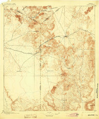
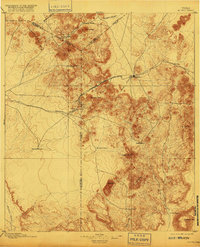
Editions of this 1895 Alpine Map
6 editions found