
1957 Map of Altair
USGS Topo · Published 1958About this map
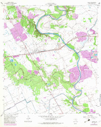
The Colorado River carves a deep, serpentine path through this 1957 landscape, defining the character of the Colorado County terrain. Near the settlement of Altair, the intersection of heavy industry and rural life is evident where the Texas and New Orleans (Southern Pacific) railroad tracks cut across the plains. The map records several vital community landmarks, including Mt Carmel Ch and the Washington Carver Sch, providing clear evidence of the mid-century social fabric. Resource extraction is a prominent theme, with the Englehart Oil Field marked by numerous oil wells and tanks, while gravel pits and strip mines line the riverbanks. For genealogists and local historians, the inclusion of Gaines Crossing (Historical) and family-named water features like Marys Branch and McKenzie Creek offers a grounded look at the local geography before more modern developments altered the drainage and transportation networks.
Find a feature on this map
23 named features on this map. Tap any name to fly to it.
Don’t see what you’re looking for? This feature index may not catch every label — zoom into the map to look around manually.
Map Details
Editions of this 1957 Altair Map
2 editions found
Other maps of this area

1953 · Seguin
USGS Topo · 1:250,000

1956 · Glidden
USGS Topo · 1:62,500

1957 · Eagle Lake
USGS Topo · 1:62,500

1957 · Columbus
USGS Topo · 1:24,000

1958 · Seguin
USGS Topo · 1:250,000

1958 · Alleyton
USGS Topo · 1:24,000

1959 · Garwood
USGS Topo · 1:24,000

1959 · Bonus
USGS Topo · 1:24,000
1963 · Eagle Lake
USGS Topo · 1:24,000
1963 · Eagle Lake NE
USGS Topo · 1:24,000