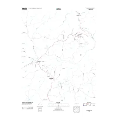
2013 Map of Altamont
USGS Topo · Published 2013About this map
Beersheba Springs and Altamont anchor this survey of the Cumberland Plateau, where the landscape is defined by the steep transition from high tablelands to deep drainage basins. The area’s historic transportation routes are visible through names like Old Stagecoach Rd and Old Highway 56, tracing the movement of travelers and goods across Grundy County before modern infrastructure reshaped the climb. Natural landmarks like the Stone Door and Pepper Hollow highlight the dramatic geology of the region, where the Collins River and numerous creeks such as Firescald Cr and Savage Cove Cr have carved the plateau’s edges. To the south, the Gruetli Gas Field and Cumberland Heights suggest the continued importance of land use and resource extraction in this part of Tennessee. This 2013 record captures the intersection of early settlement patterns and the enduring physical geography of the Savage Gulf vicinity.
Find a feature on this map
77 named features on this map. Tap any name to fly to it.
Don’t see what you’re looking for? This feature index may not catch every label — zoom into the map to look around manually.
Map Details
Editions of this 2013 Altamont Map
This is the sole edition of this map. No revisions or reprints were ever made.
Other maps of this area

1893 · Mc Minnville
USGS Topo · 1:125,000

1895 · Mc Minnville
USGS Topo · 1:125,000

1895 · Sewanee
USGS Topo · 1:125,000

1936 · Palmer
USGS Topo · 1:24,000

1936 · Burrow Cove
USGS Topo · 1:24,000

1936 · Tracy City
USGS Topo · 1:24,000

1936 · Cane Hollow
USGS Topo · 1:24,000

1943 · Mc Minnville
USGS Topo · 1:100,000
1947 · Burrow Cove
USGS Topo · 1:24,000
1947 · Tracy City
USGS Topo · 1:24,000