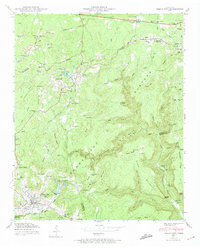
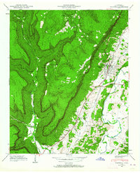
1947 Map of Tracy City
USGS Topo · Published 1974About this map
Tracy City serves as a primary hub on the Cumberland Plateau during the late 1940s, anchored by the Nashville Chattanooga and St Louis railway. The landscape reflects a legacy of extraction, with several Strip Mines and an Oil Well punctuating the plateau's surface. Local life is centered around rural landmarks like St Bernard Church and Victoria Sch, while the development of Grundy Lakes State Park indicates a growing emphasis on conservation and recreation near the coal-rich settlements of Coalmont and Gruetli. The terrain is defined by dramatic elevation changes, from the deep Sewanee Creek gorges to the high Divide between the Tennessee Valley and the Nashville watershed. Significant family and community history is preserved in sites such as Bonnie Oak Cem and Orange Hill Ch, marking the social fabric of this industrial and agricultural region.
Find a feature on this map
130 named features on this map. Tap any name to fly to it.
Don’t see what you’re looking for? This feature index may not catch every label — zoom into the map to look around manually.
Map Details
Editions of this 1947 Tracy City Map
4 editions found
Other maps of this area

1895 · Sewanee
USGS Topo · 1:125,000

1936 · Palmer
USGS Topo · 1:24,000

1936 · Whitwell
USGS Topo · 1:24,000

1936 · Burrow Cove
USGS Topo · 1:24,000

1936 · Tracy City
USGS Topo · 1:24,000

1936 · Monteagle
USGS Topo · 1:24,000

1936 · White City
USGS Topo · 1:24,000

1936 · Cane Hollow
USGS Topo · 1:24,000

1943 · Mc Minnville
USGS Topo · 1:100,000
1946 · Whitwell
USGS Topo · 1:24,000