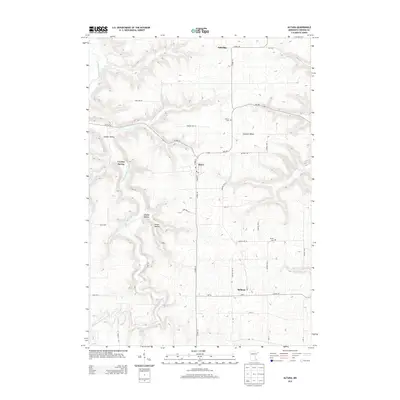
2013 Map of Altura
USGS Topo · Published 2013About this map
Altura and Bethany anchor this region of eastern Minnesota, where the agricultural uplands transition into the deeply carved drainages of the S Fork Whitewater River and Whitewater River. The landscape is defined by the sharp contrast between the level fields of Norton Twp 15 and the narrow, winding corridors of Kieffer Valley, Straight Valley, and Chaffe Ravine. These coulee-like formations channel water through the limestone-rich terrain, fed by natural features such as Crystal Spring and Holt Spring.
Find a feature on this map
49 named features on this map. Tap any name to fly to it.
Don’t see what you’re looking for? This feature index may not catch every label — zoom into the map to look around manually.
Map Details
Editions of this 2013 Altura Map
This is the sole edition of this map. No revisions or reprints were ever made.
Other maps of this area

1932 · Cochrane
USGS Topo · 1:62,500

1934 · Plainview
USGS Topo · 1:62,500

1934 · Cochrane
USGS Topo · 1:62,500

1937 · Cochrane
USGS Topo · 1:62,500

1938 · Plainview
USGS Topo · 1:62,500

1953 · Saint Paul
USGS Topo · 1:250,000

1953 · Eau Claire
USGS Topo · 1:250,000

1954 · Chatfield
USGS Topo · 1:62,500

1954 · Lewiston
USGS Topo · 1:62,500

1954 · Mason City
USGS Topo · 1:250,000