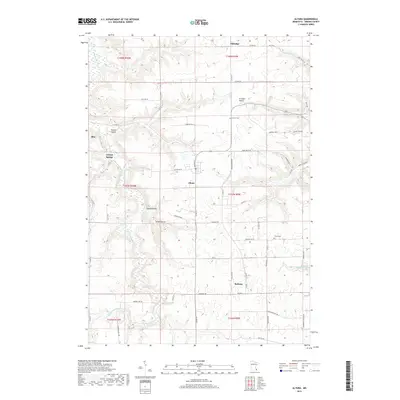
2019 Map of Altura
USGS Topo · Published 2019About this map
Altura and Bethany anchor this landscape of deep ravines and rolling uplands in western Winona County. The topography is defined by significant drainage features, including the S Fork Whitewater River flowing through the western valleys and Rollingstone Cr cutting through the southeast. Local geography is marked by distinct landforms such as Straight Valley, Chaffe Ravine, and Kohner Ridge, reflecting the complex erosion patterns characteristic of the driftless region. Genealogists can locate family sites near Hebron Cem and Trinity Cem, or trace early property lines in the surrounding townships. The presence of Crystal Spring and Holt Spring indicates the vital role of natural water sources in the development of these rural communities, which remain interconnected by a dense network of secondary roads and township routes like Co HWY 20 and Maus Dr.
Find a feature on this map
62 named features on this map. Tap any name to fly to it.
Don’t see what you’re looking for? This feature index may not catch every label — zoom into the map to look around manually.
Map Details
Editions of this 2019 Altura Map
This is the sole edition of this map. No revisions or reprints were ever made.
Other maps of this area

1932 · Cochrane
USGS Topo · 1:62,500

1934 · Plainview
USGS Topo · 1:62,500

1934 · Cochrane
USGS Topo · 1:62,500

1937 · Cochrane
USGS Topo · 1:62,500

1938 · Plainview
USGS Topo · 1:62,500

1953 · Saint Paul
USGS Topo · 1:250,000

1953 · Eau Claire
USGS Topo · 1:250,000

1954 · Chatfield
USGS Topo · 1:62,500

1954 · Lewiston
USGS Topo · 1:62,500

1954 · Mason City
USGS Topo · 1:250,000