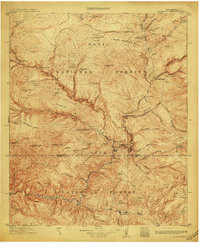
1913 Map of Alum Mountain
USGS Topo · Published 1913About this map
Gila Cliff Dwellings National Monument stands as a central historical landmark on this topographic survey of the Gila Wilderness area. At the time of this 1913 publication, the region was defined by a sparse but vital network of working cattle operations, including the V Cross T Headquarters, XSX Ranch, and the T J Ranch situated near the forks of the Gila River. The terrain is characterized by a high-altitude drainage system where the Continental Divide separates the complex canyons of the Gila National Forest and Datil National Forest. Industry is represented by the Meerschaum Mine and its associated settlement, Meerschaum, located in the southern reaches of the map. Away from the main river, the landscape opens into grazing lands such as Lily Park and McKenna Park, while smaller outposts like the Rangers Cabin and Hunting Lodge indicate early federal and recreational management of these public lands.
Find a feature on this map
95 named features on this map. Tap any name to fly to it.
Don’t see what you’re looking for? This feature index may not catch every label — zoom into the map to look around manually.
Map Details
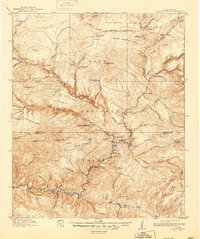
Editions of this 1913 Alum Mountain Map
3 editions found
Other maps of this area

1909 · Silver City
USGS Topo · 1:125,000

1910 · Mogollon
USGS Topo · 1:125,000

1911 · Alum Mountain
USGS Topo · 1:125,000

1912 · Mogollon
USGS Topo · 1:125,000

1913 · Alum Mountain
USGS Topo · 1:125,000

1915 · Reserve
USGS Topo · 1:125,000

1918 · Pelona
USGS Topo · 1:125,000

1918 · Reserve
USGS Topo · 1:125,000

1947 · Allie Canyon
USGS Topo · 1:24,000

1947 · Twin Sisters
USGS Topo · 1:24,000