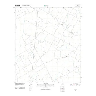
2010 Map of Alum
USGS Topo · Published 2010About this map
Ecleto Creek and its many tributaries, including East Fork Ecleto Creek and Steel Branch, dominate this rural landscape in the early 21st century. The map highlights a network of small settlements and family-associated landmarks that define the area's local history. Nockenut sits in the northeast, supported by the nearby Nockenut Cemetery and Leach Cemetery, while the small community of Alum is positioned centrally along the drainage of Alum Creek. This geography reveals a landscape transitioning from traditional ranching and farming into energy extraction, evidenced by the presence of the Scotty Oil Field and Ecleto Oil Field. Numerous county roads, such as Co RD 434 and Co RD 421, weave between these creek valleys, connecting isolated farmsteads and historic burial grounds like Neyland Cemetery.
Find a feature on this map
50 named features on this map. Tap any name to fly to it.
Don’t see what you’re looking for? This feature index may not catch every label — zoom into the map to look around manually.
Map Details
Editions of this 2010 Alum Map
This is the sole edition of this map. No revisions or reprints were ever made.
Other maps of this area

1920 · Smiley
USGS Topo · 1:125,000

1936 · Floresville
USGS Topo · 1:62,500

1942 · Dewville
USGS Topo · 1:62,500

1953 · Seguin
USGS Topo · 1:250,000

1954 · San Antonio
USGS Topo · 1:250,000

1956 · Dewville
USGS Topo · 1:62,500

1957 · San Antonio
USGS Topo · 1:250,000

1957 · New Berlin
USGS Topo · 1:24,000

1958 · Seguin
USGS Topo · 1:250,000

1961 · Nixon
USGS Topo · 1:24,000