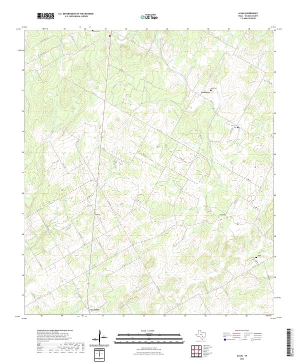
2022 Map of Alum
USGS Topo · Published 2022About this map
Nockenut and Alum anchor this rural Texas landscape, where the drainage of Ecleto Cr and its tributaries define the settlement patterns. The area is characterized by a network of local roads such as FM 1681 E and Oilfield Rd, serving a countryside marked by family-named landmarks and traditional burial grounds. Genealogists will find significance in the distribution of sites like Nockenut Cem, Leach Cem, and Neyland Cem, which sit isolated among the creeks. The southern edge of the survey reaches the outskirts of Stockdale, showing the transition from open grazing and oil-producing land to more concentrated town planning. Numerous water features, including Steel Br, Clifton Br, and Alum Cr, cross the terrain, illustrating the hydrologic network that has shaped property lines and agricultural use in Wilson County for generations.
Find a feature on this map
52 named features on this map. Tap any name to fly to it.
Don’t see what you’re looking for? This feature index may not catch every label — zoom into the map to look around manually.
Map Details
Editions of this 2022 Alum Map
This is the sole edition of this map. No revisions or reprints were ever made.
Other maps of this area

1920 · Smiley
USGS Topo · 1:125,000

1936 · Floresville
USGS Topo · 1:62,500

1942 · Dewville
USGS Topo · 1:62,500

1953 · Seguin
USGS Topo · 1:250,000

1954 · San Antonio
USGS Topo · 1:250,000

1956 · Dewville
USGS Topo · 1:62,500

1957 · San Antonio
USGS Topo · 1:250,000

1957 · New Berlin
USGS Topo · 1:24,000

1958 · Seguin
USGS Topo · 1:250,000

1961 · Nixon
USGS Topo · 1:24,000