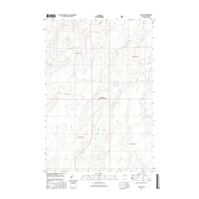
2015 Map of Alvin SE
USGS Topo · Published 2015About this map
Nicolet National Forest dominates this northern Wisconsin landscape, characterized by a complex network of waterways and managed timberlands. The Pine River flows through the northern reaches, while the southern portion is defined by the Popple River and its tributary, the N Br Popple River. These river systems, along with scattered water bodies like Rat Lake, Waite Lake, and Rogers Lake, suggest a terrain primarily shaped by glacial activity and long-standing forestry practices. Transportation in this area is limited to a grid of forest service roads, such as Pine River Rd, Macarthur Pine Rd, and Forest Rd 2170, which facilitate access for land management and recreation. The absence of major settlements reflects the protected status of the national forest and the preservation of the native headwaters of the Lake Michigan drainage basin.
Find a feature on this map
24 named features on this map. Tap any name to fly to it.
Don’t see what you’re looking for? This feature index may not catch every label — zoom into the map to look around manually.
Map Details
Editions of this 2015 Alvin SE Map
This is the sole edition of this map. No revisions or reprints were ever made.
Other maps of this area

1938 · Alvin
USGS Topo · 1:48,000

1939 · Crandon
USGS Topo · 1:48,000

1939 · Laona
USGS Topo · 1:48,000

1939 · Long Lake
USGS Topo · 1:48,000

1941 · Crandon
USGS Topo · 1:48,000

1946 · Laona
USGS Topo · 1:48,000

1946 · Alvin
USGS Topo · 1:48,000

1947 · Crandon
USGS Topo · 1:48,000

1948 · Long Lake
USGS Topo · 1:48,000

1954 · Iron Mountain
USGS Topo · 1:250,000