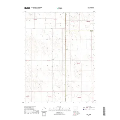
2019 Map of Alvin
USGS Topo · Published 2019About this map
Alvin sits at the heart of this high plains landscape, positioned near the intersection of several local routes in Yuma County. The terrain is defined by the subtle, rolling topography of the Colorado and Nebraska borderlands, where the state line divides the survey into distinct jurisdictions. Near the eastern edge of the Colorado territory, the Hughes Cem serves as a primary genealogical landmark along Rd 724. The map reveals a strictly gridded system of rural transport, including Co Rd 51 and Co Rd 52, which anchor the agricultural character of the region. This 2019 survey documents the enduring settlement patterns of the tri-state corner, where the boundaries of Chase and Dundy Counties in Nebraska meet Yuma County, Colorado, reflecting a quiet continuity in this prairie environment.
Find a feature on this map
23 named features on this map. Tap any name to fly to it.
Don’t see what you’re looking for? This feature index may not catch every label — zoom into the map to look around manually.
Map Details
Editions of this 2019 Alvin Map
This is the sole edition of this map. No revisions or reprints were ever made.
Other maps of this area

1954 · Sterling
USGS Topo · 1:250,000

1954 · McCook
USGS Topo · 1:250,000

1957 · McCook
USGS Topo · 1:250,000

1958 · McCook
USGS Topo · 1:250,000

1958 · Sterling
USGS Topo · 1:250,000

1971 · Alvin NW
USGS Topo · 1:24,000

1971 · Alvin SW
USGS Topo · 1:24,000

1971 · Alvin
USGS Topo · 1:24,000

1971 · Wray NE
USGS Topo · 1:24,000

1971 · Alvin NE
USGS Topo · 1:24,000