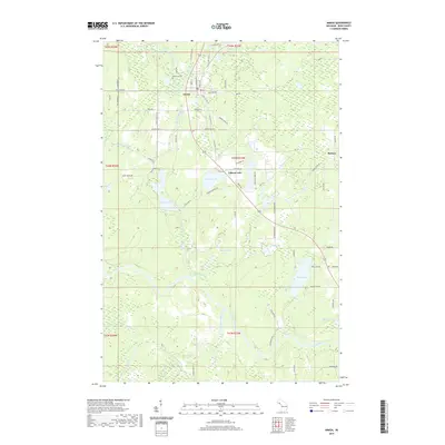
2019 Map of Amasa
USGS Topo · Published 2019About this map
The settlement of Amasa serves as the primary hub of this Iron County landscape, positioned near the Hemlock River and Little Hemlock River. The town's historical roots in the region's mining industry are evidenced by infrastructure like Warner Mine Rd, while the Hematite Cem reflects the genealogy of early residents near the banks of Cemetery Lake. The map reveals a dense network of water bodies and marshlands, including Gibson Lake, Fire Lake, and Swan Lake, connected by numerous creeks and sloughs.
Find a feature on this map
78 named features on this map. Tap any name to fly to it.
Don’t see what you’re looking for? This feature index may not catch every label — zoom into the map to look around manually.
Map Details
Editions of this 2019 Amasa Map
This is the sole edition of this map. No revisions or reprints were ever made.
Other maps of this area

1895 · Ned Lake
USGS Topo · 1:62,500

1895 · Perch Lake
USGS Topo · 1:62,500

1898 · Iron River
USGS Topo · 1:62,500

1899 · Crystal Falls
USGS Topo · 1:62,500

1944 · Crystal Falls
USGS Topo · 1:24,000

1944 · Gaastra
USGS Topo · 1:24,000

1944 · Fortune Lakes
USGS Topo · 1:24,000

1945 · Sunset Lake
USGS Topo · 1:24,000

1945 · Kelso Junction
USGS Topo · 1:24,000

1945 · Amasa
USGS Topo · 1:24,000