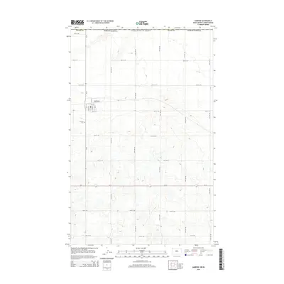
2014 Map of Ambrose
USGS Topo · Published 2014About this map
Ambrose sits in the northwest corner of Divide Co, North Dakota, marking a stark landscape just south of the international border with Saskatchewan. This high-plains region, mapped in the early 21st century, showcases a highly structured grid of section lines and gravel roads that define the rural character of the area. The settlement itself serves as a quiet center for the surrounding agricultural tracts, with the surrounding topography characterized by hundreds of small depressions and seasonal wetlands typical of the prairie pothole region. These natural features, combined with the straight-line human development of 100th-series streets and avenues, illustrate the enduring tension between the wild, glaciated terrain and the formal township-and-range surveying system.
Find a feature on this map
2 named features on this map. Tap any name to fly to it.
Don’t see what you’re looking for? This feature index may not catch every label — zoom into the map to look around manually.
Map Details
Editions of this 2014 Ambrose Map
This is the sole edition of this map. No revisions or reprints were ever made.
Other maps of this area

1948 · Crosby SW
USGS Topo · 1:24,000

1948 · Ambrose
USGS Topo · 1:24,000

1948 · Crosby
USGS Topo · 1:24,000

1948 · Crosby SE
USGS Topo · 1:24,000

1950 · Crosby
USGS Topo · 1:62,500

1953 · Williston
USGS Topo · 1:250,000

1957 · Williston
USGS Topo · 1:250,000
1983 · Colgan East
USGS Topo · 1:24,000
1983 · Colgan SE
USGS Topo · 1:24,000

1984 · Crosby
USGS Topo · 1:100,000