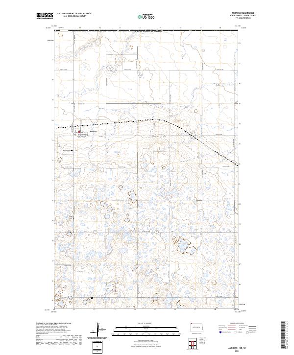
2024 Map of Ambrose
USGS Topo · Published 2024About this map
Ambrose sits at the northern edge of Divide County, positioned just south of the international border with the United States of America. This prairie landscape is defined by the rigid grid of the Public Land Survey System, with townships like t163n r99w and t164n r98w organizing the terrain into square-mile sections. The town itself is built around a small cluster of streets, including Main St and Valley St, with its southern boundary marked by the curious name of Lovers Lane Ave. The surrounding countryside is dotted with countless small wetlands and seasonal depressions, characteristic of the pothole region. Local history and genealogy are anchored by two distinct burial sites: Ambrose Cem to the west and Immanuel Cem further south, providing clear points of reference for researchers tracing the area's early families. Modern transportation relies on ND 5, which cuts through the southern sections of the quadrangle.
Find a feature on this map
32 named features on this map. Tap any name to fly to it.
Don’t see what you’re looking for? This feature index may not catch every label — zoom into the map to look around manually.
Map Details
Editions of this 2024 Ambrose Map
This is the sole edition of this map. No revisions or reprints were ever made.
Other maps of this area

1948 · Crosby SW
USGS Topo · 1:24,000

1948 · Ambrose
USGS Topo · 1:24,000

1948 · Crosby
USGS Topo · 1:24,000

1948 · Crosby SE
USGS Topo · 1:24,000

1950 · Crosby
USGS Topo · 1:62,500

1953 · Williston
USGS Topo · 1:250,000

1957 · Williston
USGS Topo · 1:250,000
1983 · Colgan East
USGS Topo · 1:24,000
1983 · Colgan SE
USGS Topo · 1:24,000

1984 · Crosby
USGS Topo · 1:100,000